Linguistic landscape (LL) research has always been shaped by the tools available for capturing, organizing, and interpreting public signage, and each technological advance has widened what researchers are able to document and ask. This is evident in highly multilingual settings, where the field researcher may not be competent in all the languages available in the public space, leading them to rely on digital tools to recognize unfamiliar scripts.
One of the earlier technological contributions addressed location and collection. Barni and Bagna’s (2009) MapGeoLing used smartphone GPS to locate signs on the map, enabling quantitative analysis of linguistic distribution across space. Mobile applications then standardized the photographic capture and geotagging of signs: LinguaSnapp (Gaiser & Matras, 2021) built a structured LL archive, while Lingscape (Purschke, 2017) adopted a citizen-science model in which members of the public crowdsource LL signs.
Another contribution concerns analysis. Mignone (2025) used the qualitative data analysis software ATLAS.ti to build a coding system grounded in geosemiotics, uploading photographs and assigning codes manually alongside interview transcripts and fieldnotes within a single project. This integration supports queries and co-occurrence analysis across a dataset, but the coding itself remains a manual, researcher-driven act. More automated approaches have come from urban studies: Hong (2020) applied computer vision and machine learning to extract and code text from online street-level imagery in order to demonstrate linguistic diversity across urban space.
Today, artificial intelligence (AI) has infiltrated our lives in more ways than seemed possible just a few years ago, shaping the way human knowledge is produced and consumed. The rapid developments in large language models and computer vision makes AI an appealing prospect for LL research. Voss (2024) proposes generative AI for indexing, hypothesis generation, and interpretive support, arguing that it should function as a research assistant in dialogue with the researcher rather than as a replacement for analytical judgment: “Researchers must use AI technologies responsibly and consider them as tools to augment human expertise rather than replace it” (p. 419). This framing sharpens a methodological question: what can AI do with LL data? At a minimum, it can identify signs, transcribe, and translate text, and it can process data according to researcher-defined coding—provided its interpretation is constrained to predetermined codes rather than left open.
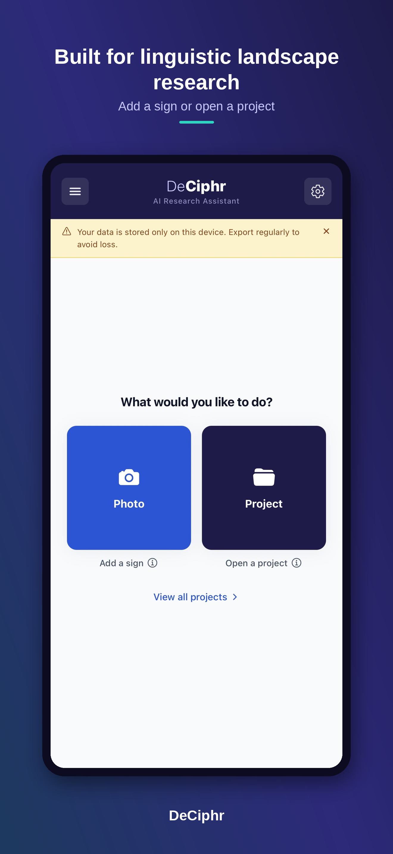
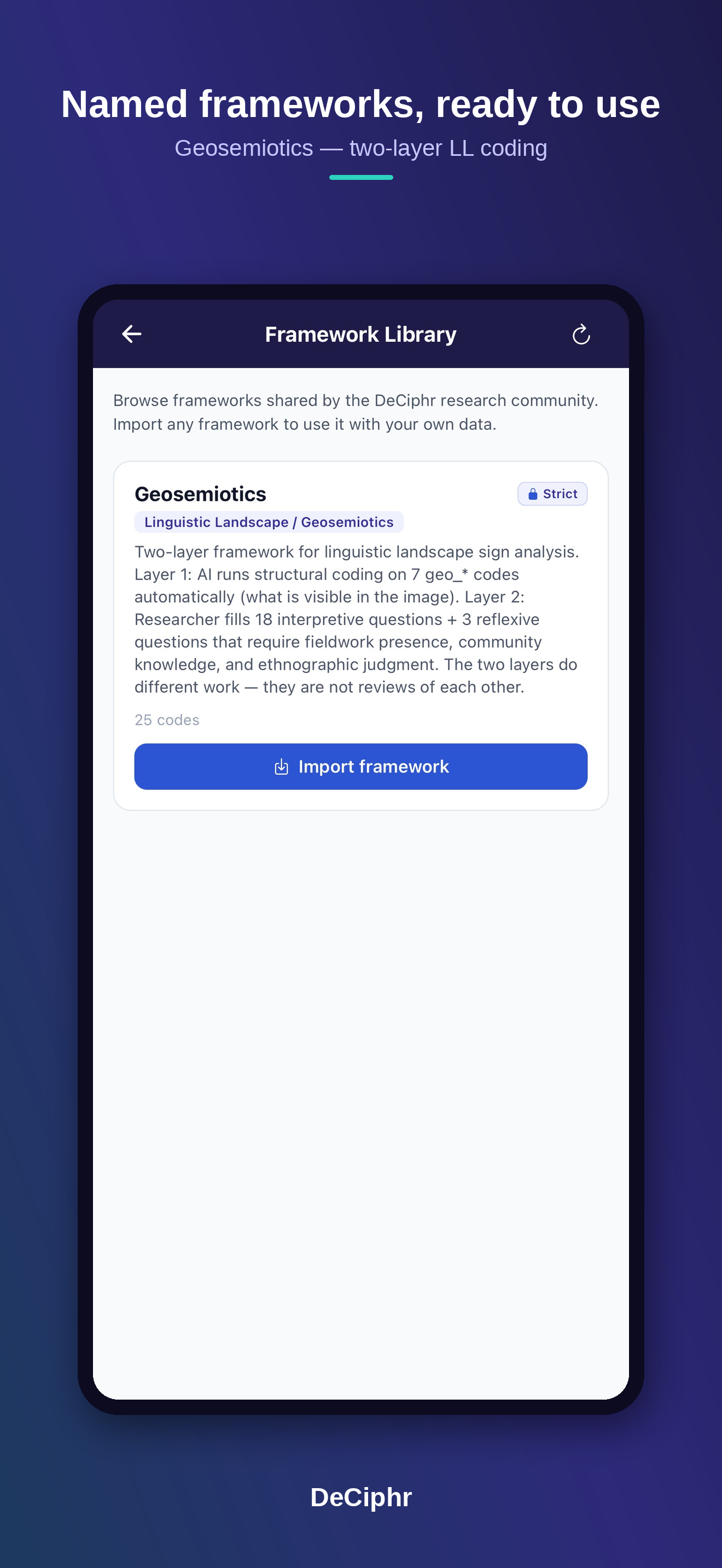
DeCiphr is the tool I have developed in response to this question. It is a smartphone and web application for coding LL data in which the researcher creates or imports a coding framework and the AI codes within it. As a mobile application, it is designed as a fieldwork companion in multilingual contexts, processing signs as they are collected—translating and coding on site, in the conditions my own project demands. Each framework defines its codes, definitions, and permissible values, and is organized into two layers.
Developing a coding framework based on geosemiotics (Scollon & Wong Scollon, 2003), Layer 1 holds the deductive codes the AI assigns: seven geosemiotic codes including code preference, inscription, emplacement, represented participants, modality, composition, and interactive participants. Here the AI records only what is visually present: languages, layout, font, and composition. It returns “Uncodable” wherever the visual evidence does not warrant a confident assignment. Layer 2 holds interpretive questions that the researcher alone answers, drawing on fieldwork presence, community knowledge, and ethnographic judgment. The AI cannot answer these by design, and the researcher retains authority throughout, able to edit both the processing and the Layer 1 output.
This division clarifies both the potential and the limitations of AI for qualitative LL research. Its potential is considerable: it can manage large data, support translation across unfamiliar languages, and give the researcher more time to concentrate on interpretation, while its guiding questions can scaffold students and less experienced researchers. However, it can be argued that the same guiding questions that scaffold early researchers may also produce shallow or restrictive responses. Another issue to consider is agency: allowing the researcher to edit AI output distributes agency and accountability across human and machine in ways that are difficult to disentangle. It is also important to remember that large language models are not trained evenly across cultures, and this unevenness affects coding, transcription, and translation alike.
Taken together, these tools trace a clear trajectory from locating and collecting signs, to organizing and querying them, to coding them. DeCiphr extends that trajectory into AI-assisted coding while deliberately preserving the researcher’s interpretive authority. Treated as a research assisting tool, AI has the potential to strengthen the reflexive, qualitative work at the heart of LL research without displacing the researcher’s role.
References
Barni, M., & Bagna, C. (2009). A mapping technique and the linguistic landscape. In E. Shohamy & D. Gorter (Eds.), Linguistic landscape: Expanding the scenery (pp. 126–140). Routledge.
Gaiser, L., & Matras, Y. (2021). LinguaSnapp Manchester: Multilingualism revealed. University of Manchester.
Hong, S.-Y. (2020). Linguistic landscapes on street-level images. ISPRS International Journal of Geo-Information.
Mignone, O. (2025). Vital signs: Tibetan in the linguistic landscape of Jackson Heights [Doctoral dissertation, City University of New York].
Purschke, C. (2017). Crowdsourcing the linguistic landscape: Introducing Lingscape. Linguistik Online, 85(6).
Scollon, R., & Wong Scollon, S. (2003). Discourses in place: Language in the material world. Routledge.
Voss, E. (2024). Artificial intelligence and linguistic landscape research: Affordances, challenges & considerations. Linguistic Landscape, 10(4), 400–424.